Empowering Clean Energy Innovation
Data-driven tools and resources for policymakers, investors, and renewable energy stakeholders
Interactive Energy Atlas
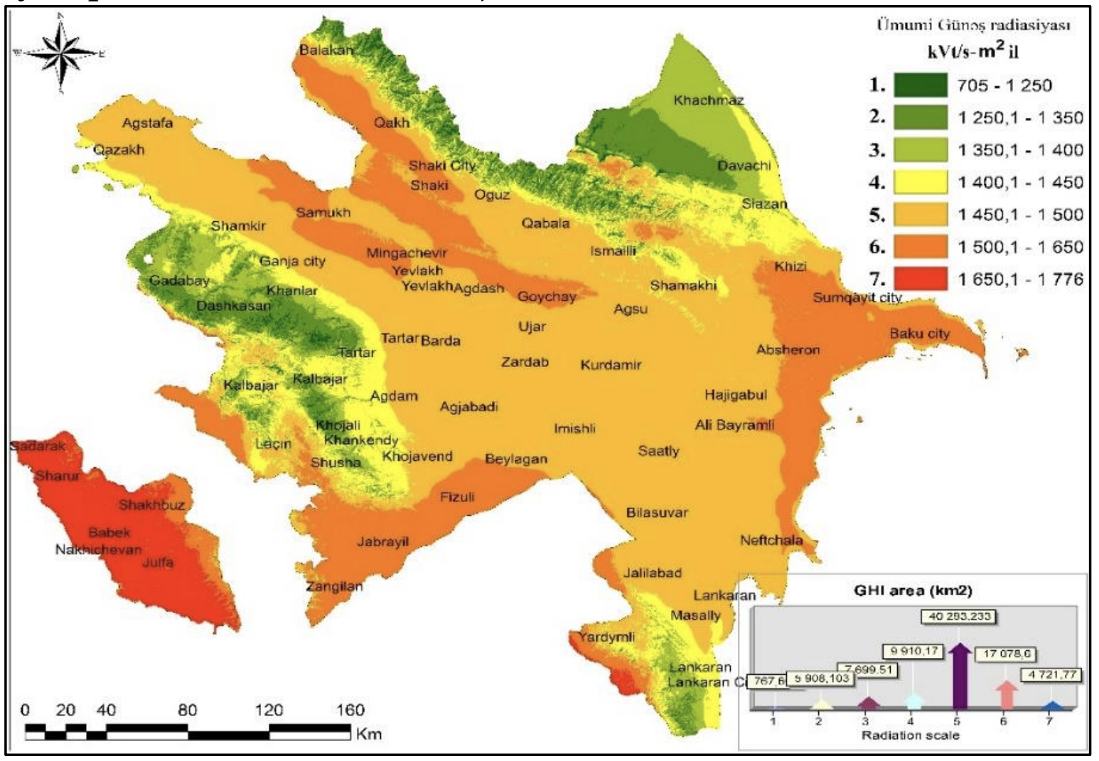
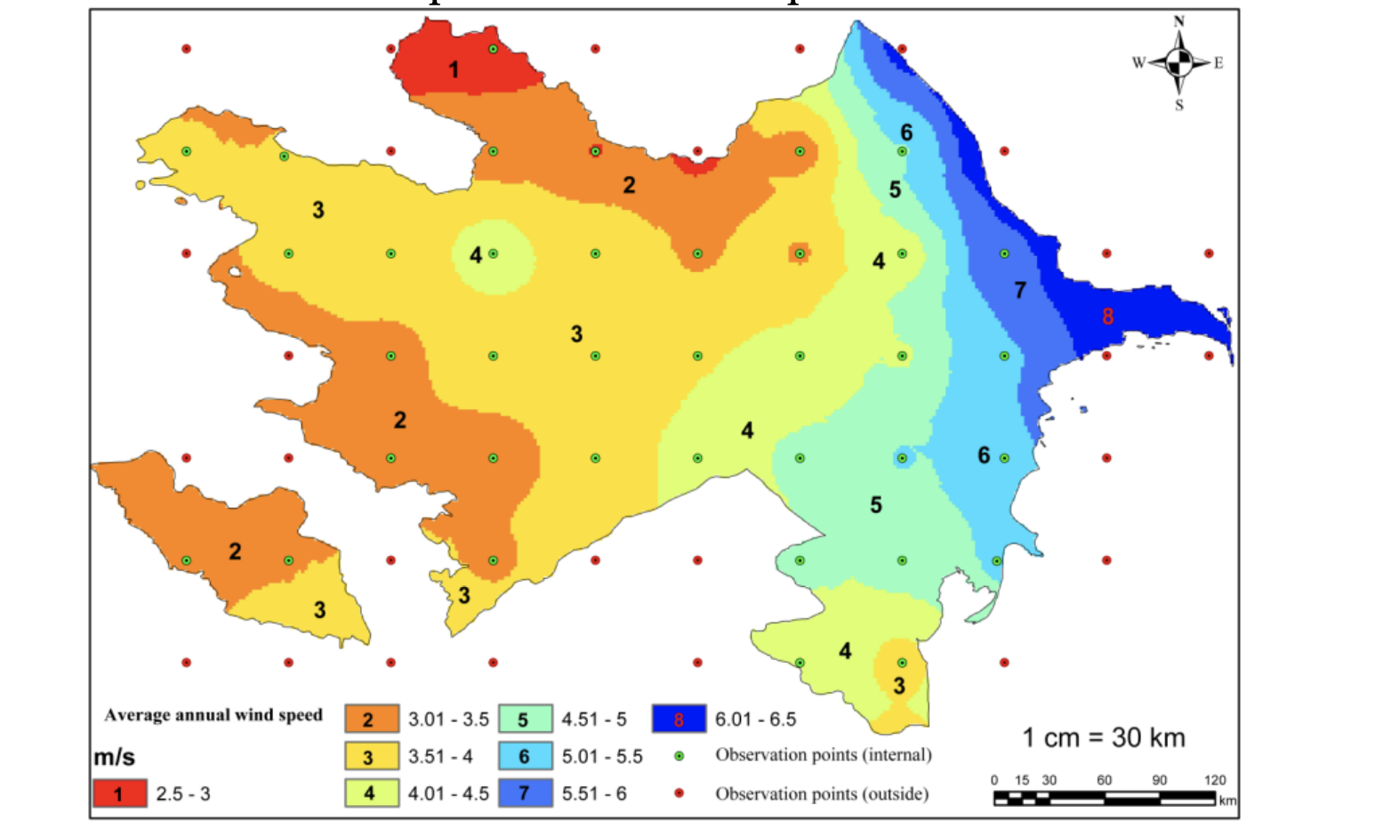
Rayon-level mapping of Azerbaijan's 27 GW renewable potential with detailed solar, wind, and hydro data. Explore project pipelines, existing installations, and untapped opportunities.
Explore Map →Regulatory Framework Hub
Comprehensive database of Azerbaijan's green energy laws, presidential orders, NDC commitments, and investment mechanisms. Stay updated on policy evolution.
View Frameworks →Investment Intelligence
Track major renewable projects, PPAs, auction frameworks, and GW-scale MoUs with international partners like Masdar, ACWA Power, and bp.
Explore Projects →Strategic Planning Tools
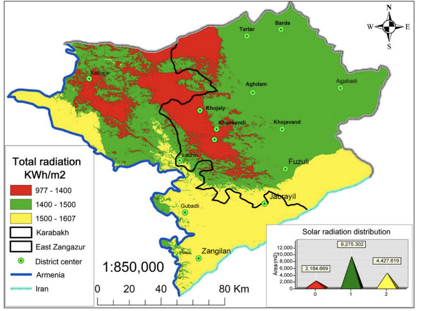
Access data on green energy zones (East Zangazur, Karabakh), infrastructure capacity, grid connections, and regional export corridors.
View Details →Academic-Grade Data
All energy assessments backed by peer-reviewed research, Ministry of Energy data, and World Bank reports. Verified, transparent, and actionable.
See Sources →

COP29 Leadership
Showcasing Azerbaijan's commitment to tripling global renewables by 2030 and establishing Karabakh/East Zangazur as a green recovery showcase.
Learn More →Interactive Energy Atlas
Rayon-level mapping of Azerbaijan's 27 GW renewable potential with detailed solar, wind, and hydro data. Explore project pipelines, existing installations, and untapped opportunities.
Explore Map →Regulatory Framework Hub
Comprehensive database of Azerbaijan's green energy laws, presidential orders, NDC commitments, and investment mechanisms. Stay updated on policy evolution.
View Frameworks →Investment Intelligence
Track major renewable projects, PPAs, auction frameworks, and GW-scale MoUs with international partners like Masdar, ACWA Power, and bp.
Explore Projects →Strategic Planning Tools
Access data on green energy zones (East Zangazur, Karabakh), infrastructure capacity, grid connections, and regional export corridors.
View Details →Academic-Grade Data
All energy assessments backed by peer-reviewed research, Ministry of Energy data, and World Bank reports. Verified, transparent, and actionable.
See Sources →
COP29 Leadership
Showcasing Azerbaijan's commitment to tripling global renewables by 2030 and establishing Karabakh/East Zangazur as a green recovery showcase.
Learn More →